DiveNET:
GPS iLBL
Rapidly Deployable Wireless Wide-Area Underwater GPS
DiveNET: GPS is a patented series of portable, self-contained and rapidly deployable, wireless, wide coverage area underwater GPS navigation systems utilizing a common technological platform and set of primary functional components. All DiveNET: GPS systems utilize a floating (inverted) long baseline (LBL) array consisting of four lightweight hydroacoustic GPS buoys (AGB) and support Diver and unmanned applications. The DiveNET: GPS series includes three standard models or ‘tiers‘ offering distinctive functional or operational advantages to meet a variety of customer needs and budgets: Commercial, Professional, Explorer. The DiveNET: GPS series is designed for hassle-free ownership, minimum maintenance requirements, rapid deployment and ease of operation. DiveNET: GPS utilizes common industry interfacing standards and data formats supporting data export and integration with third party systems.


TYPE :
LBL
MODEL :
Commercial

-
True underwater GPS
-
Portable, self-contained and rapidly deployable
-
Unlimited number of subsea GPS Receivers
-
Wide coverage area
-
Sub-meter precision
-
Robust and simple to own and operate
-
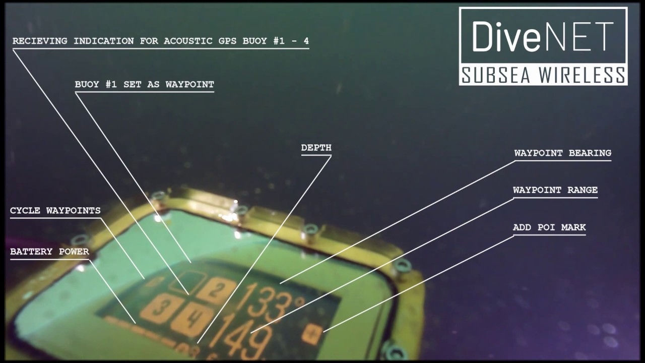
Diver display for waypoint navigation and POI marking
-
GPS emulation output and data export
-
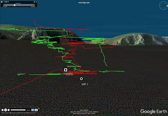
Dive track recording
-
Open architecture for OEM integration


DiveNET Explores the USS Spirit of America Shipwreck


Parameter | Commercial | Professional | Explorer |
|---|---|---|---|
Nominal precision | 0.84 m (2DRMS) | 0.84 m (2DRMS) | 1.5 m (2DRMS) |
Update rate | 1 sec | 2 sec | 2 sec |
Max relative velocity | 1.8 m/s | 1.8 m/s | 2 m/s |
Maximum coverage area | 2000 x 2000 m | 1500 x 1500 m | 300 x 300 m |
Maximum depth | 300 m | 300 m | 300 m |
Solution availability | Subsea (topside repeater via cable) | Topside | Topside |
Maximum carriers | Unlimited | 1 (pinger); >1 (5x5 voice comm) | 1 (pinger) |